The Nevada Landscape 2009 - 2011
These images are selected from work done during a sabbatical project 2009 to 2011. It is my own personal interpretation of Nevada, the way I see the colors, subject matter and unique settings. Many of these images are not “scenics” but rather a documentation of the land and how man has moved upon it.

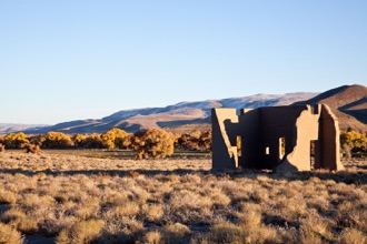
Smoke Creek Desert from an Abandoned Porch 2010


Fog on the Fernley Sink 2010
Old Road - Soldier Meadow 2010
Old Hwy Alt 93 near Wendover with Pilot Peak 2010

Blue Lakes near Wendover looking down the UT/NV Line 2010

WWII Army Air Base Water Tank - Wendover, UT/NV 2010


Lone Rabbit Brush - High Rock Canyon 2010
High Rock Canyon 2010
The Humbolt River at Beowawe 2010
Storm Cell over Jobs Peak near Carson Valley 2010
Hot Springs - BLM Campground, Soldier Meadow 2010

Granite Boulders near Contact 2010


Fence Line - Charnac Basin, Monitor Range 2010
Fence Line near Austin 2009

Approaching Storm near Carson City 2011


Hinkey Summit with Contrail and TV Antenna 2010
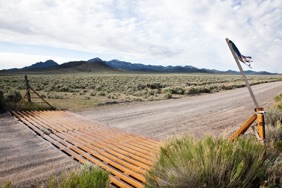
Cattle Guard - Belmont Road Take Off with Monitor Range
First Alert Building on Road to Denio 2010
Old Road - Antelope Valley near Eureka 2010
Spencer Hot Springs in the Big Smoky Valley 2010
Carson River Cottonwoods with Ft. Churchill 2010

Earthquake Road with Fairview Peak 2010


Kelly Creek Equivalent - Monitor Range 2010
Hunters’ Kitchen - Alison Creek, Monitor Range 2010

RR Overpass near Dunphy 2010

Moving Train at Rye Patch Reservoir 2010

Moving Train near Battle Mountain 2010


Sand Mountain Recreation Area - Salt Wells Basin 2011


Sunset - Lamoille Canyon near Elko 2010
Lake Lahontan in Winter 2010


Truckee River at Painted Rock 2010
Lamoille Canyon - Ruby Mountains 2010


The Carson River near Gardnerville 2010
Lifting Storm at Pleasant Valley 2010


Late Afternoon - Genoa 2010
The Carson River near Gardnerville 2010

Sharon House - Virginia City 2010


Houses on “C” Street - Virginia City 2010
Sheds on Taylor Street - Virginia City 2010

The Jackson Range through a Storm Cell - Quinn River Valley 2011


Crested Wheat and Cheatgrass - Santa Rosa Range 2011
Cattle Grazing - Santa Rosa Range 2011

Early Spring Run Off through a Cheatgrass Burn 2011

Windy Day at Walker Lake 2011


Boat Scene - Walker Lake 2011
Cemetery at Goldfield 2011

Old Dump Yard - Goldfield 2011


Wildcat Peak near Beatty 2011
Elbow Range near Las Vegas 2011
Pahute Mesa 2011
Pahute Mesa 2011
Arrow Canyon Range near Coyote Springs 2011
Spotted Range near Indian Springs 2011

Coyote Springs near Alamo 2011

Joshua Tree Forest near the Delamar Valley 2011

Cathedral Gorge State Park near Panaca 2011

Wheeler Peak near Ely (west side) 2011

Sunset - Steptoe Valley near Ely 2011
All images were taken with a Canon 5D Mark II digital camera. The photographs are all printed at 16” x 24” on 17” roll paper using Epson Ultrachrome K3 ink for archival permanence.
